

.webp)


By Sanjeev Kumar Patro
Bhubaneswar: Even as a low pressure area will take shape by October 4 over North Bay of Bengal, close to the West Bengal coast, the relatively cooler and calmer Arabian seas seem hot enough to conceive cyclone genesis in next 192 hours.
There seems to be a degree of model concurrence over probable cyclone genesis over south Arabian sea on and around October 9. In tandem with the development of a weather system, many places in Maharashtra, including Mumbai, and coastal Gujarat may record rainfall in the range of 2-4cm.
As per the NCUM-G model forecast by NCMRWF, on October 8, a cyclonic circulation will form over the south Arabian seas, close to Karnataka coast. And, on and around October 11, a low pressure area will most likely to be formed over central Arabian seas.
The model forecasts of ECMWF and NCEP-GFS are in concurrence with NCUM-G prediction. Even the national weather agency IMD has predicted a cyclonic circulation over Arabian seas, on and around October 7/8, though its model forecast hasn’t predicted the probability of cyclonegensis. Nevertheless, the national weather forecaster has predicted some rainfall activities over Maharashtra, including Mumbai, on 9, 10,11 and 12.
NCEP-GFS is the only model that is predicting a severe cyclone in the Arabian seas by October 18.
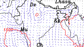
FORECAST FOR BAY OF BENGAL
In addition to the low pressure area over north Bay of Bengal on and around Oct 4, almost all models are unanimous in predicting formation of a cyclonic circulation in South west Bay of Bengal close to south Andhra Pradesh coasts on and around October 7.
The national weather forecaster IMD’s GFS has quite a clear prediction of the system evolving into a low pressure area over next 24-48 hours and, as a consequence, induce rainfall activities over some places in northern Tamil Nadu, Telangana and coastal Andhra Pradesh from October 8 onwards and up to Oct 10.
ECMWF model is also in consonance with IMD. NCMRWF's NCUM-G, though, predicts a cyclonic cicrculation, it does not see formation of low pressure area.
ODISHA RAIN
Notwithstanding two low pressure areas predicted in Bay of Bengal, Odisha is predicted to remain mostly dry till October 8.
The coastal, southern and western parts of the State may witness rainfall activities in the range of 2cm on and around October 11, 12 and 13.
The model forecasts prediction indicates no wide spread rains across the State. But many places in the coastal districts, including Bhubaneswar, southern and western districts may witness rainfall in the range of 20-40 cm during the Durga Puja festival time.
CYCLONE LIKELY In BAY OF BENGAL?
As of now, none of the model forecasts hint at a lurking cyclone in the Bay of Bengal. The low level wind circulation only indicates of high moist laden cross equatorial winds flowing to the Bay of Bengal. But the atmospheric conditions over the bays predict no troughs to induce vorticity to the high cross equatorial winds blowing to the bay of Bengal till October 19.
.webp)