
.webp)
Satellite photos expose shocking destruction across flooded Himalayan valleys
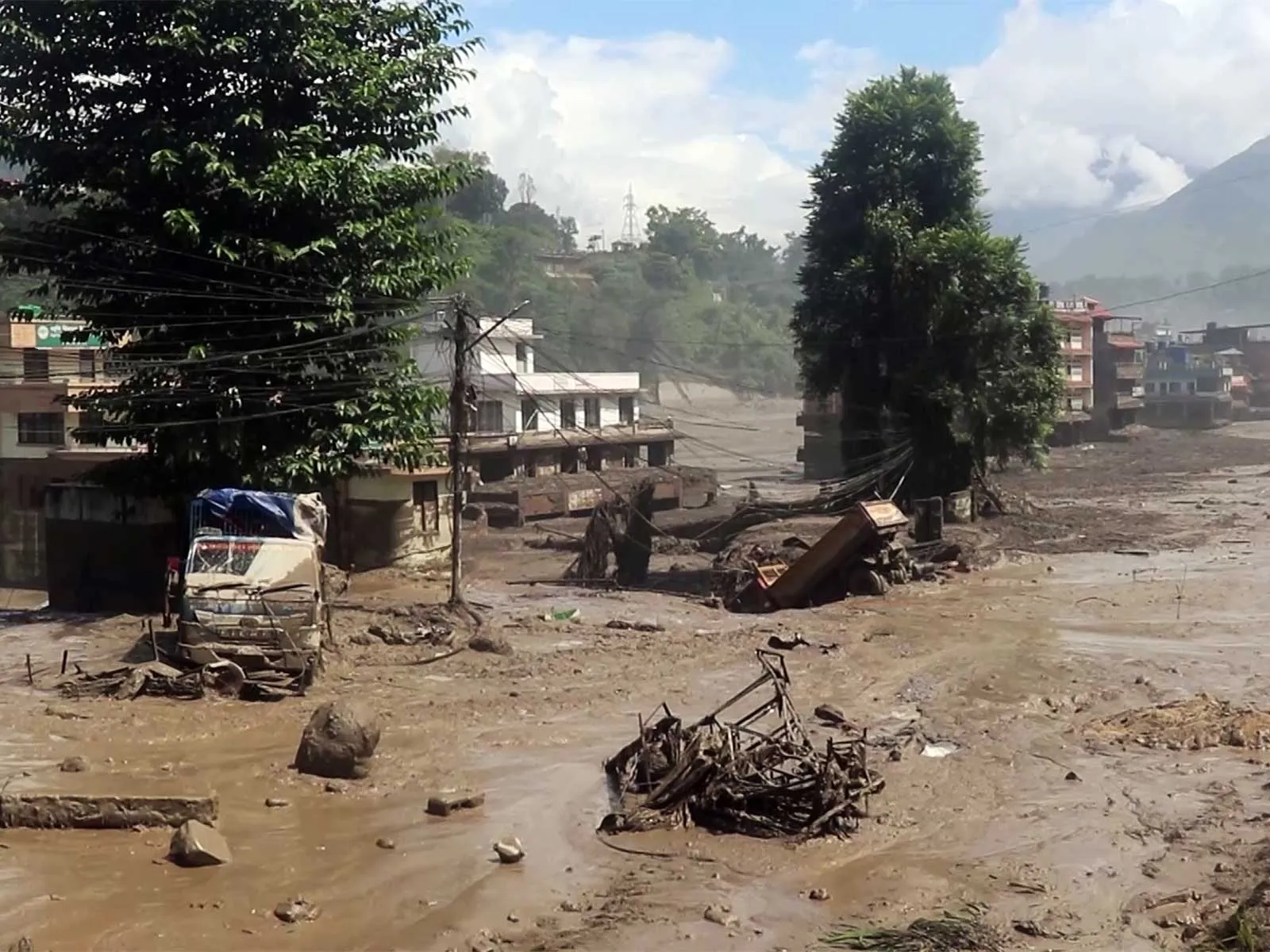
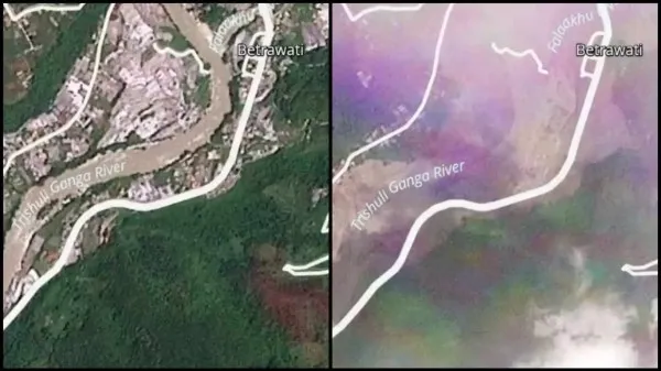
Fresh satellite photos reveal severe destruction across Himalayan valleys following sudden floods near the Tibet border. Planet Labs captured these dramatic changes between August 23 and August 26, recording a destructive surge of debris that erased entire settlements. Surging waters abruptly altered the natural landscape along the Bhote Koshi River in Rasuwa district. Authorities confirm 175 people have died in this disaster, while nearly above 400 individuals remain missing. Rescue officials note this missing list includes at least 105 Indian nationals and 37 non-resident Indians caught in the deluge.
Tracing Flood Origins
Initial reports indicate an ice avalanche originating from an unstable mountain rock mass triggered this sudden disaster. This icy collapse occurred roughly 20 kilometers northeast of the Tibet-Rasuwagadhi border area. Himalayan valleys face increasing risks from sudden glacial lake outbursts due to rising global temperatures and regional seismic instability. Floodwaters carved completely new channels through the valley floor, transforming once-green zones into muddy wastelands. Settlements like Manakamana and Khadga Bhanjyang experienced extreme topographical changes within just three days.
Rescue Operations and Indian Support
Emergency teams continue battling harsh weather conditions and complete communication blackouts to locate survivors. Fast-moving water destroyed critical suspension bridges, vital roads, and multiple regional hydropower facilities. Prime Minister Narendra Modi reached out to Nepal Prime Minister Balen Shah to offer complete humanitarian assistance during this crisis. Meanwhile, National Disaster Response Force personnel remain on high alert across vulnerable downstream zones in Bihar and Uttar Pradesh. Water experts anticipate rising levels in the Gandak River as this destructive wave moves southward into Indian territory.

Before and after - Devighat
Image Courtesy: PBSLabs via NDRRMA
.webp)