
.webp)

Tremor Strikes Off Flores Coast
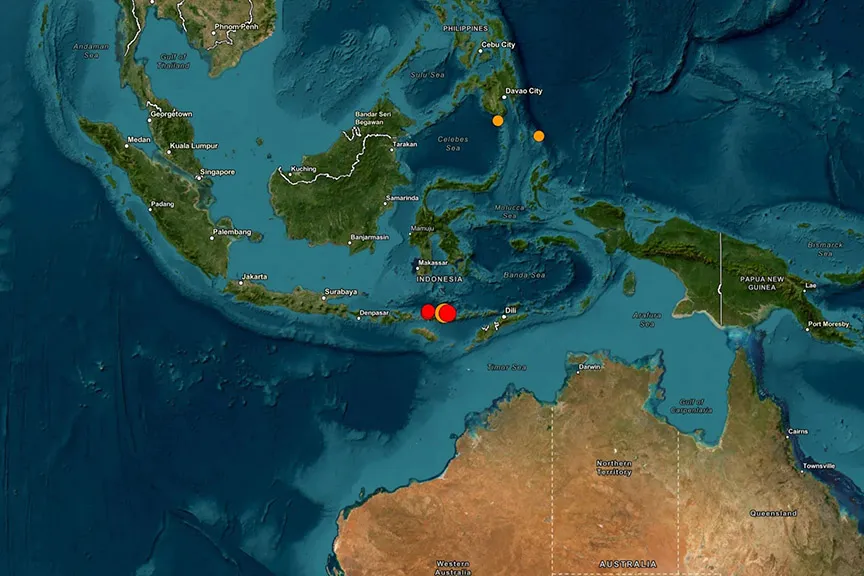
Coastal settlements across eastern Indonesia plunged into panic early Saturday after a powerful 7.7-magnitude earthquake hit the waters off Flores Island. Data recorded by the US Geological Survey placed the shallow epicentre approximately 68 kilometres northwest of Ende. Multiple strong aftershocks rattled the region shortly after, including a significant 6.1-magnitude jolt that sent terrified residents rushing into open spaces.
Evacuations and Tsunami Alerts Issued
Emergency response teams initiated immediate coastal evacuations across East Nusa Tenggara, South Sulawesi, and West Nusa Tenggara. Indonesia's Meteorology, Climatology, and Geophysics Agency issued high-priority tsunami warnings for waves reaching up to three metres. Local monitors soon detected preliminary sea level fluctuations between 19 and 30 centimetres along vulnerable shores.
In Maumere, witnesses observed coastal waters rapidly receding before people fled toward higher ground. Hospital staff in regional medical centres moved patients outdoors after tremors cracked building walls. Lukas Lotar, an eyewitness working at a local hospital, reported sudden intense shaking that caused widespread panic and visible structural fractures across facility corridors. Images from Nagekeo regency showed damaged residential buildings, though emergency services have not confirmed any casualties.
Seismic Vulnerability in the Region
Geological instability remains a constant reality for the Indonesian archipelago because it sits directly atop the Pacific Ring of Fire. This vast tectonic arc spans Southeast Asia and drives frequent volcanic eruptions alongside major fault line ruptures. Indonesia has weathered several historic disasters, including the catastrophic 9.1-magnitude tremor and tsunami in 2004, alongside the deadly 2018 Lombok and Palu events. Disaster management teams continue to monitor regional shorelines closely for secondary surges.
image Courtesy: Bloomberg.com
.webp)