

.webp)


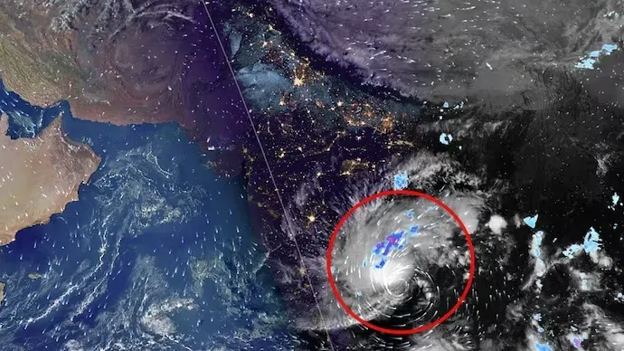
Cyclone ‘Akvan’ to hit Andhra Pradesh first, then move towards Odisha
Bhubaneswar, Nov 18: Cyclone ‘Akvan’ is likely to make a significant impact on Andhra Pradesh, with wind speeds reaching 120–130 kmph and gusts touching 145 kmph during landfall on November 20. Although Odisha is unlikely to face the cyclone’s full intensity, southern districts, particularly Malkangiri, may experience strong winds and heavy rainfall.
According to the India Meteorological Department (IMD), the cyclone is expected to pass close to Motu along the Odisha–Andhra Pradesh border. Wind speeds in Malkangiri could reach around 70 kmph when the system makes landfall near Visakhapatnam.
IMD Director General Mrutyunjay Mohapatra said the system is likely to intensify into a severe cyclonic storm by Tuesday night, with wind speeds of around 90 kmph. It is expected to intensify further into a very severe cyclonic storm on November 19, before crossing the coast between Nellore and Tuni around noon on November 20.
The IMD has forecast heavy to very heavy rainfall in several parts of Odisha. On November 19, Kendrapara, Jagatsinghpur, Gajapati, Ganjam and Puri are likely to receive heavy to very heavy rainfall. Heavy showers are also expected in Baleswar, Bhadrak, Jajpur, Cuttack, Angul, Dhenkanal, Keonjhar, Mayurbhanj, Boudh, Kandhamal, Rayagada, Koraput, Malkangiri, Khordha and Nayagarh.
On November 20, southern Odisha is likely to receive heavy rainfall, while Sundargarh, Jharsuguda, Bargarh, Nuapada, Nabarangpur and Koraput may experience heavy showers on November 21.
Continuous rainfall could trigger landslides and flooding in low-lying areas.
However, weather experts have offered differing assessments. Dr Sarat Sahu of SOA's Centre for Climate and Weather expects the cyclone to weaken after landfall, bringing winds of 70–80 kmph and light to moderate rainfall in Odisha.
Another agricultural meteorology expert has predicted landfall between Kalingapatnam–Srikakulam and Baruva–Gopalpur on November 20 morning, with wind speeds of around 74 kmph. The system may weaken into a depression near Rayagada by evening.
With varying predictions on the cyclone's intensity and landfall location, southern Odisha remains vulnerable to heavy rainfall and strong winds.
.webp)