

.webp)


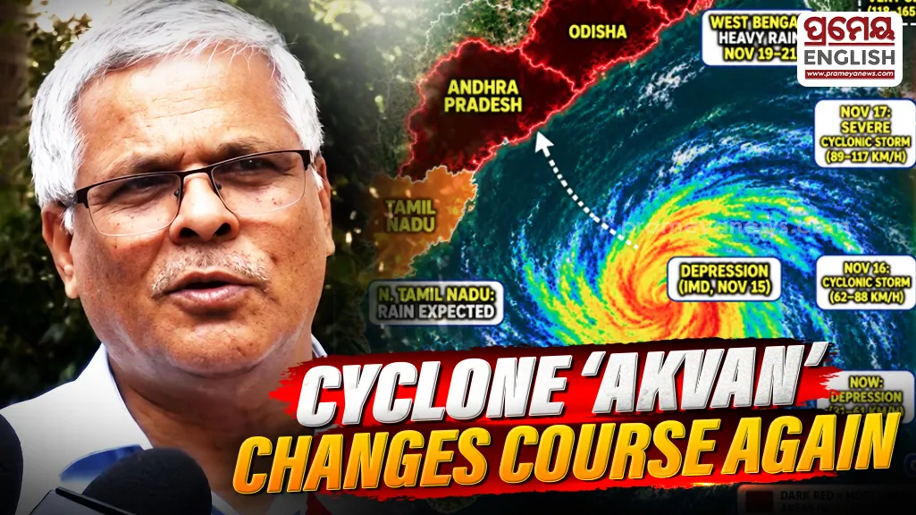
Bhubaneswar, Nov 17: Uncertainty continues over the possible track of Cyclone Akvan, with weather models frequently changing their predictions regarding its direction and landfall. Although the system has shown a slight slowdown in its intensification process, models indicate that it could gain strength over the next 36 hours.
The cyclone's movement has also undergone several changes. Initially, it was moving in a north-northwest direction before changing course towards the east-northeast.
According to the latest model predictions, the system is now likely to move in a northwesterly direction towards Telangana. These changes could affect both the timing and location of its possible landfall. Current estimates suggest that landfall before November 20 is unlikely.
Also Read: Cyclone Akvan Alert: BeMC issues helpline number
Irrespective of the cyclone's eventual track, Odisha is likely to experience rainfall due to changes in wind patterns associated with the system.
Between November 18 and 20, several coastal districts of Odisha may receive light to moderate rainfall. Heavy rainfall is also likely at one or two places during this period.
Rainfall activity along the Odisha coast may gradually decrease from the afternoon of November 19. However, interior parts of the state could witness increased rainfall activity.
In the area where the cyclone eventually makes landfall, wind speeds may reach 80 to 100 kmph.
However, the impact of strong winds in Odisha is expected to remain comparatively limited. Wind speeds across the state may reach a maximum of 40 to 50 kmph.
.webp)