

.webp)
Mindanao coastline reels following double high-intensity seismic strikes
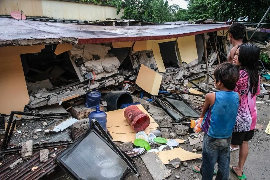
Mindanao Island in the southern Philippines faced severe geological disruptions early Monday morning when a powerful 7.7 magnitude earthquake struck the region. Data released by the National Centre for Seismology specified that the initial quake hit at 5:07 AM Indian Standard Time, originating at a deep-focus depth of 93 kilometers. Minutes later, a secondary structural fracture occurred at 5:18 AM, registering a 6.4 magnitude tremor at a depth of 79 kilometers.
Geologically, this specific boundary region sits directly on the highly volatile Pacific Ring of Fire, mirroring the complex fault lines that frequently trigger massive underwater subduction events across Southeast Asia.
Understanding Deep-Focus Seismic Threats
According to structural categorization systems managed by the United States Geological Survey, these twin tremors fall squarely into the intermediate to deep-focus classification. Earthquakes originating deeper than 70 kilometers often spread lower-intensity shaking over vastly wider geographical areas compared to shallow rifts. Disaster management units across neighboring provinces are currently evaluating coastal vulnerabilities, as regional ocean sensors remain on alert for sudden wave displacements following the seabed displacement.
With Inputs from Agency Threads
.webp)