


.webp)


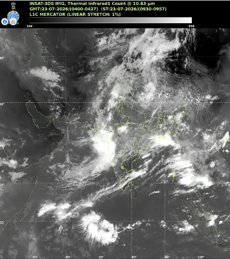
Broad Cloud Belt Triggers Regional Rainfall Surge
Satellite imagery captured a massive 10,000-kilometer monsoon cloud band extending from northern India across China to South Korea on July 23, 2026. This convergence zone formed as Indian Ocean moisture linked with continental weather fronts, driving daily precipitation levels to nearly 180% of normal averages nationwide over two days. Thick cloud coverage now extends across central, northern, and eastern parts of the nation. Low-pressure systems moving inland from the Bay of Bengal continue feeding moisture into eastern regions. Heavy downpours hit Uttar Pradesh, Uttarakhand, Punjab, Delhi-NCR, and Rajasthan, significantly lifting seasonal totals. Bay of Bengal weather systems driving east-to-west rainfall corridors play a crucial role in stabilizing agriculture in eastern states like Odisha while refilling crucial hydrological reservoirs.
While this wet phase aids Kharif crop planting and addresses seasonal rainfall shortfalls, regional authorities warned of flash floods, landslides, and river swelling in hill states like Himachal Pradesh and Uttarakhand. Meteorologists expect active conditions to persist throughout the week.
.webp)