


.webp)
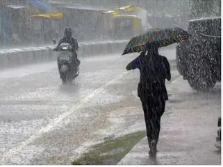
Bhubaneswar, July 26: Heavy rain under the low-pressure system lashed several parts of Odisha, with Biridi of Jagatsinghpur recording highest rainfall of 328 mm rainfall during the last 24 hours (till 8.30 AM of Sunday). Eight other locations recorded more than 100 mm of rain during the last 24 hours, according to rainfall data.
While Jujumara, Nakatideula and Redhakhola of Samblpur district recorded 275.4 mm, 145.0 mm and 129.0 mm rainfall, respectively, Balipatna of Khordha district witnessed (125.0 mm) rainfall, Batagaon of Sambalpur district (120.0 mm), Gaisilet of Bargarh (114.0 mm), Jharbandh of Bargarh (112.0 mm), Rajkanika and Rajnagar of Kendrapara district (108.0 mm each) and Bari of Jajpur district (100.0 mm).
Rainfall recorded at other places included Kakatpur of Puri 99.0 mm followed by Angul (96.0 mm), Bijepur of Bargarh district (96.0 mm), Sonepur (95.2 mm), Tihidi of Bhadrak district (92.0 mm), Kantamal of Boudh district and Agalpur of Balangir district (91.0 mm) each, Jagatsinghpur (90.4 mm), Dunguripali of Sonepur (90.0 mm), Barapali of Bhadrak and Balangir (87.0 mm) each, Balikuda of Jagatsinghpur and Kendrapara (85.0 mm), Gop of Puri (85.0 mm), Sonepur (84.0), Patamundai of Kendrapara district (83.0 mm), Pipili of Puri (82.2 mm) and Ullunda of Sonepur (82.0 mm).
Meanwhile, the India Meteorological Department (IMD) on Sunday forecast heavy to very heavy rainfall, with isolated extremely heavy rainfall, over Odisha on July 26 and July 27 amid a well-marked low-pressure area over the northwest Bay of Bengal and adjoining Odisha-West Bengal coasts.
“The Low Pressure Area over west Bengal coast & adjoining northwest Bay of Bengal lay as a Well-marked Pressure Area over northwest Bay of Bengal & adjoining Odisha-West Bengal coasts at 0530 Hrs 1ST of today, 26th July 2026. The associated cyclonic circulation extended upto 9.4 km above mean sea level. It is very likely to concentrate into a depression over the same region during next 12 hours. It is likely to move northwestwards and cross North Odisha-West Bengal Coasts around 27th July, 2026 forenoon,” it said.
Meanwhile, the State Government also asked the district Collectors to keep a close vigil of the situation and take proactive measures to mitigate any emerging situation
.webp)